Showing posts with label skiing. Show all posts

10 November 2012

A desperate search for snow, but a lovely camp out

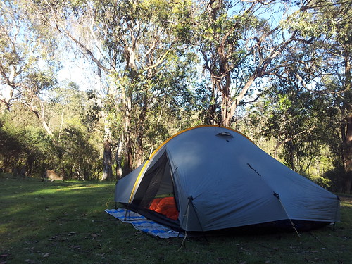
Ron picked me up on Friday arvo, and we head into the Upper Murray, approaching the Main Range from the West. We camped at Tom Groggin first night.


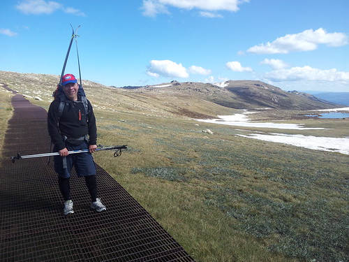
Caught the lift up from Thredbo the next morning, and trekked up Mt Kosciusko, then across toward Mt Townsend, in search of skiable snow. We found a few runs, but it was pretty sparse. 


We missed the lift back down, the walk hurt. Drove round to Island Bend where we met Thor, Robbie and Karen and a few others. They'd set up Thor's hot tub next to the Snowy River, and at about midnight I overcame my phobia of sharing a bath, and enjoyed a sensational experience under the Milky Way drinking a beer.


08 October 2012

Great snow, skiing Hotham, testing Peak Oil Jackets


At last, we had the opportunity to test the 2 prototype jackets in snow and blizzard conditions out back of Mount Hotham Victoria. Here's a video we made on phones, from the 2 days skiing testing:


So what did we learn?

We first pulled one of the jackets out of the bag when we stopped to put chains on the car. Yep, being canvas we could confidently chuck the jacket down in the mud and rocks, and not worry about pressing a hole in it.


Our first day was spent resort skiing. We're happy to confirm both prototypes kept us warm, dry and protected, including on the slow lift rides over the ridge and into the howling southerly that blew all day.

The unworn surface of the oiled canvas seemed to catch and hold the needle and stella snow flakes a bit, compared to the plastic jackets around us, but we suspect that's because the jacket was new, with the surface being kinda furry. By the end of the second day, we noticed the surface was starting to get that signature shine of a worn oilskin, and snow fell away.


The Riri Aqua zips worked beautifully! They set, glide and unset effortlessly. Easily the best waterproof zip out there. We'll change the placement of the zip though. We thought to end the front zip at the neckline, leaving the studs and plackets to close the neck, and keep it free and flexible. We wanted to avoid that slight stiffness that a zip can bring to the neck, but we concede this is not a big enough problem to warrant loosing the ease of the zip. In future makes, for the jackets that have the Riri Aqua zips, we'll place them up over the neck, and leave off the plackets and studs.


The difference between the Peak Oil Jacket prototype 2 and 3 is in the sleeve. On the 2 we set the sleeve in, meaning a seam runs over the shoulder and under the arm. On the 3 we used a raglan sleeve, where the seams run up to the neckline. We think the raglan fits better and offers more freedom of movement, but we'd like to work a bit more on the set-in sleeve, and experiment with a removable sleeve design.


The pockets. We reckon 4 pockets on the front is overkill. We didn't use the 2 lower pockets at all, and the vertical zip was difficult to manage. Either we'll leave off the lower pockets, or rethink their placement to reflect the rarity of their use. The two breast pockets where very useful though, and the vertical Aqua zips made them easy to access with a pack on.


The hoods covered well, and in these conditions they're a must have - both fully on, or half up the back of the head with the collar all done up. We're looking for a better way to do hoods though, that fits them to all different head and neck sizes, that blocks all wind, and keeps fitted on a moving head. We're also conscious that some people like to remove the hood, we've got a few ideas...

We're not sure the Ventile lining needs to be sewn in. We're thinking to try a removable lining so to make it washable and replaceable, plus the added versatility of using the liner alone, or swapping it for insulation.

Finally, the weight question. These jackets are heavier than their plastic counterparts, but we honestly didn't notice a difference. We spent a day resort skiing, followed by a pretty big day back country, which had us wearing them in a full range of situations and body temperatures. They packed down into our bags no trouble, and seemed to feel nicer than the plastics when we wore them climbing out of a valley.


All up, we're stoked the prototypes worked in the conditions we're designing for. They're confidently tough, perform well in snow conditions, feel good when active, and the weight didn't bother us on these extended day trips. This first test has shown us we're on the right track, and with a few minor tweaks we'll have a jacket we're proud to put out to market.
24 October 2011

Mount Townsend


A few weeks ago, Robbie, Thor and I camped out on Watson's Crags, and admired the view and long steep runs coming down off Mount Townsend to Albina Lake and Lady Northcoat Canyon. Yesterday, Thor and I walked and skinned out to Townsend, and easily found the long line down. A fantastic line it was too! And we're talking late October here! People are sweating it out on the beach, just 3 hours drive from here!


The night before we drove up the Charlottes Pass, and camped under the veranda of the chalet. Next morning we walked to Seamam's Hut, dropped down to the Snowy, climbed up to Townsend, Dropped down below Lake Albina, climbed into Little Austria, Dropped down next to Club Lake and back to the Snowy River up to Charlottes, and home by 730pm.


MAP


View Australian Back Country Skiing in a larger map


FOOTAGE

19 September 2011

Outback Watsons


Thor, Robbie and I camped at Island Bend on Friday night, so we could get an early start from Guthega, up Mount Twynam. The walk to the suspension bridge over the Snowy River was almost completely without snow. Reliably the snow was all the way to the river on the other side though, and our climb to Twynam and then onto Watsons Crags was straight forward.

The winds on Saturday were to be very strong through the night, so we dug in up a north arm of Strzelecki Creek. With an outstanding view across Carruthers Peak to Mount Townsend, we sat drinking miso soup, discussing our next trip all the way to Townsend.

The skiing was beautiful spring corn, delivering us far down steep valleys, for punishingly hot climbs back out. A great weekend.

Here's a video I made of it.


Here's the map


View Australian Back Country Skiing in a larger map


And the photos start here (click right).

22 August 2011

Outback Old Matt

Old mate Matt Jones, down from the Northern Territory, or more recently - Queensland, came with me into another type of Australian Outback, up Guthega Trig for a little walk, and a look, and a try at skiing. Can't say he enjoyed the skiing part, but I think he appreciated the views.

More photos


View Matt Jones Outback in a larger map


14 August 2011

Guthega, Farm Creek, The Paralyser, back to Guthega


Thor and I headed out expecting powder, but were disapointed to find rain washed snow, breakable crust, and an all over ice sheet. Climbing up Farm Creek to the saddle and then around to The Paralyser was lovey though, easy going, through beautiful snow gums. Taking our time allowed the sun to soften the snow in time for a great fun cruise back down through the trees. We spotted some nice looking intermediate and accessible terrain for when the snow is good.


View Guthega, Farm Creek. Mount Paralyser, Guthega in a larger map

30 July 2011

Guthega Trig, Consett Stephen Pass, Mount Tate


I got up at 5 this morning, and rode to Thor's, from where we drove to Thor's mate Billy, and we all headed up to Guthega for a windy day on the Trig to Consett Stephen Pass, and onto Mount Tate. I was on some borrowed leathers and skinnies, and had a bit of a bad time on them, wishing for my solid fatties and plastics, with trusty skins to get me up there. Billy was impressive though, his skills in leather ankle boots and skinnies, better than most new-school skiers I've seen. Check out the reo he pulls on the cornice, first time without the camera was even better. Finding these perfect snow slopes off Gill's Nob made the day. Video was shot and edited all on the phone!


View Guthega Trig, Consett Stephen Pass, Mount Tate, in a larger map

03 October 2010

Eve and Sunshine come back for a spot of snow camping


Despite Eve showing some signs of a cold brewing, we headed off for an over night on the snow. I packed and humped a serious load of bedding, and we made it through a pretty warm but sleepless night as Eve's cold set in. We hiked a little way up the Trig Ridge from Guthega, and camped on the second knoll looking South West over the Guthega River, and the dam with the Snowy feeding it. It was lovely to be out there with all the little family, and I even got some late afternoon and early morning turns in. Lovely spring conditions all over with plenty of snow around.

Photos start from here.

25 September 2010

Watsons Crag


Thor and I took a trip out to Guthega for an afternoon climb of Twynam, sunset ski on Watsons Crag, and full moon ski down through Blue Lake and back to Guthega. The spring corn was a delight to ski, and the weather was perfect. The white out right twilight was a worry, but the moon came out just as we skied down to Blue Lake. On the traverse back along the Snowy, one small but persistent cloud obscured the moon almost all the way back. Finding our way back on snow was a challenge in the bush, ending in us humping our gear on foot. It was an exhausting but great day/night out.

Photos start from here

16 August 2010

Powder Day

Robbie and Clint drove up to Guthega last week, camped at Island Bend, and sent me a picture text the next morning of perfect looking powder! Thor and I arrived the next day and we all enjoyed turns down off Tate East Ridge, down the more Southerly aspects, especially the slopes down to the dam. What a great day!

05 August 2010

Mount Twynam

Robbie, Thor and I head out to Guthega together to climb Mount Twynam, and ski down to Blue Lake. We were expecting fresh powder from the days before, but found nasty ice sheets and variable wind blow. It wasn't until we were half way down the fantastic Blue Lake Creek above Blue Lake itself, that we finally found our powder.

After the mammoth traverse back, and having climbed a total of 800m, and skied and traversed some 20km, we were all totally shagged. It was another wonderful day in the backcountry though.. :)

Photos


Map with embedded panoramas

View Track 5 in a larger map

26 July 2010

Leather Barrel

Another day trip for back country. This time meeting Richard at Thredbo for a day out past Ram's Head, down into Leather Barrel, across Swampy Plains River and up Mt Kosciusco and back over Ram's Head and home through Thredbo.

Photos


Map


View leather barrel in a larger map

19 July 2010

Out back Guthega

I had the most outstanding day in the back country skiing yesterday. Thanks to Sunshine for letting me escape baby duty for the day :)

Here's the video on Youtube (and on Blip)


The video is pretty long and indulgent on my part sorry (8.46min). It captures a memory for me, so I don't mind so much... a had-to-be-there thing. Hope you all get through at least one sitting. The music should see you through at least, 2 tracks from CCMixter:
  1. "Just so Picky" by Speck
  2. "Through the Edge" by PorchCat
I watched the weather all week, with a large low pressure front chock full of moisture coming down to dump a bunch of snow on Wednesday and Thursday, followed by a dry high pressure Southerly to keep the conditions cold and dry, but letting the sun shine through to soften off any crust. I was skinning my way out back bright and early on Saturday morning :)

Here's the photos on Picasa (and Flickr).


Eve woke at 5am - quick nappy change and pass to mummy in bed, and I was out the door for a 3 hour drive to Guthega. Skipped Cooma for a more reasonably priced breakfast at Berridale, then on past Jindabyne and up the range. Was on skis and crossing the Guthega dam wall at 9am.  

Here's the map.


View Mount Tate and Mount Anderson in a larger map


From Guthega Village (the lift station) drop down the road to the Dam. Cross the Dam and follow the track to the upper reaches of the North arm about 1km until you see a foot bridge crossing the Guthega River. Either continue on the east bank of the river to access the pass, or cross the bridge and continue on the river bank up to access Mount Tate. Others seem to head straight up the East face of Tate East Ridge and follow the ridge line from there.

08 July 2010

First ski Australian slopes

Pretty disappointing first ski in Australia. Love the backcountry atmosphere, hate the massive fees and over done resorts.

Got up early, easy driving to Cooma for breakfast and take away lunch (will stop at Berridale next time), lovely sunrise coming into Jindabyne. Stopped at Paddy Palin's for a map, then onto the Park gates for the nasty surprise of a $27 fee for a 1 day pass! Then a few ks up the road, a random chains check!!!? No warning signs back at Jindabyne, no snow anywhere near the road, no forecast of snow for days, if not weeks. They wouldn't hear it, and turned me back to Jindabyne to get chains! Another $25 hire, so I bought a set for $160. There went my early start, budget well blown.

Finally arrived at Perisher to find the road to Charlottes Pass closed with no snow on it! $48 for a 15min bus ride.. forget it! Perisher was crowded out with only man made snow runs open, yet they were charging full fee lift passes at $110 for a day! I just wanted to get out back, but their $28 single lift pass is not available for people with skis!

So skinned up Back Perisher Mountain for good views out to Main Range. Looked like good cover out over Carruthers Peak and Blue Lake, probably a strong crust on it though, and having not gone through to Charlottes, the walk was huge! Very patchy cover on the ridges Mnt Perisher to Blue Cow - fun for cross country. I dropped down to Blue Calf, and up Blue Cow for one run down a crowded Kamikaze.

Tired and broke, I walked back to the car and drove home. Studying the map for less expensive access alternatives. Fuel from Canberra return is about $60, park entry is $24 per day. This cost would be less if the Snowpool website works out, leaving a little for a lift pass, or a bus to Charlottes to access the backcountry for a day trip.. otherwise it's a long walk and a sleep out.. but then the park fees build up!

I hear Victorian parks are all free entry...

Some photos of this trip.. forecast says a dump to come late next week!

02 May 2010

Australian backcountry skiing

Sunshine, Eve and I took a drive up to Guthega on the weekend, to scope out a ski trip for when the snow falls. Inspired!

Lots of people scoff at the idea of Australian skiing. Personally I like it more than anywhere.

Wikipedia has a great article on skiing in Australia, and check out my little map with videos:


View Australian Back Country Skiing in a larger map

07 September 2009

Last ski in the NZ back country


Even though we have no money, 2 days of dumping snow followed by perfectly still and sunny days was too much to resist. Avalanche warning went down from high to considerable, so we packed our probes and shovels and went in search of powder.

Sure enough, dropping into Cardrona's back bowl, we found some lovely fresh, with only a slight wind effect to keep us alert. We climbed the West Ridge back up, looked for the loaded pow and dropped down 800m vert of uninterrupted bliss.

Nothing can over state the sensation of floating in air as you fall down a mountain you have spent hours climbing.


21 June 2009

An attempt to ski Mount Pisa


View Pisa in a larger map

Robin has had this place scoped for a while, so the weekend after the big snow day Shelagh, Robin, Sunshine, the dogs and I all head off for a look see. We stayed the night in a really nice little holiday house in Bannockburn, getting up long before the sun so we could start our way up a long steep route to the Pisa range.

I must admit, when I saw the maps, I had my doubts that Sunshine and I would make it up to a snow line, ski it and get back in one day, but Shelagh and Robin had packed for an over night stay in a hut up over the range on the Cardrona Cromwell Pack Track. That was a better plan as the climb to the snow line was too big for Sunshine and I in a day, seeing us turn back :(

It was a little disappointing to see the snow line wasn't anywhere near the 900m we had hoped, and the car pack was at 400m. Had we bought a 4WD along, we could have driven all the way to the snow line and into it! But the road was boggy in patches after the sun had melted the frost over it - the driving should be done early morning only I'd say...

The view we did get of the range and the bowls and valleys coming off it was enough to inspire a return.. but it is definitely a committing trip, and not one for less than 2 days.

17 June 2009

A snow day


It snowed all day across Dunedin yesterday. The town services closed down including the Polytech, so we could all go out and play.

And play we did! Skiing around the Peninsula! That's less than 200 metres above sea level!

It kept snowing all day. In the afternoon Mike and I skied from Larnach Castle down to Broad Bay!


View Dunedin Ski in a larger map

25 May 2009

Awakino

After the dump, we drove to Awakino, a small ski field up near Kurow up the Waitaki River North West of Oamaru. Its a really nice spot, forgotten it seems by most skiers in New Zealand. It doesn't seem to get as much snow as some of the more popular areas, but it would be a great access point for some pretty special touring after good snow.